| |
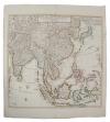
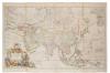
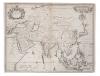
Laurie & Whittle (1794-1818), engraved map - 'The Coast of India from Pulo Timon to Pulo Cambir comprehending The Malayan Coast, The Gulf of Siam, the Coasts of Tsiampa and Conchinchina with the adjacent Islands and part of the Isle of Borneo', published 12th May 1794, 55cm x 69cm
£40 - 60
|
|
|
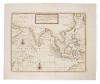
Guillaume de L'Isle (1675-1726), hand-coloured map - 'Carte des indes et de la Chine', 'Chez Jean Covens et Corneille Mortier', 1700, 62cm x 63cm.
£120 - 180
|
|
| |
George Le Rouge (fl. 1740-1780), hand-coloured map - 'Isles Philippines', 22cm x 28cm
£40 - 60
|
|
| |
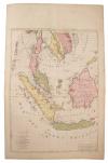
George Le Rouge (fl. 1740-1780), two hand-coloured maps - 'Isles de la Sonde '; 'Isles Moluques ', 22cm x 28cm
£40 - 60
|
|
| |
William Home Lizar (1788-1859), coloured engraving - 'Part of Asia', 38cm x 45cm., together with Emile Levasseur (1828-1911), two hand-coloured engravings - 'Asia'; 'Oceanie', both 1847, from Atlas Universal Illustre. John Lothian (fl. 1825-1846), coloured engraving - 'East India Islands', 28cm x 34cm (1844), Charles Knight & Co., hand-coloured engraving, circa 1860, 27cm x 26cm.. (5)
£40 - 60
|
|
| |
Gerhard Mercator (1512-1594), two hand-coloured maps - 'Java Maior', one with Latin text verso (Benjamin Wright caelevit), the other English text verso, both 9cm x 13cm.
£150 - 200
|
|
| |
Matthaus Merrian (1593-1650), engraved map - 'India Orientalis et Insulae Adiecentes', 1646 (1670- 1680), 27cm x 36cm.
£80 - 120
|
|
|
Pierre Mortier (1661-1711), hand-coloured map - 'lLe Royaume de Siam avec les Royaumes qui luy font tributaries et les Isles de Sumatra Andemaon etc.' 1700, 79cm x 56cm
£100 - 150
|
|
| |
Charles Theodore Middleton, hand-coloured map - 'An accurate map of the East Indies.' (1777-1779), from Complete System of Geography, 20cm x 30cm.
£40 - 60
|
|
| |
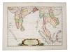
Alessandro Malaspina (18th/19th century), engraved map - 'Plan of the Bay of Manila in the Isle of Luconia, The Principle of the Philippine Islands', 1798, 51cm x 34cm
£20 - 30
|
|
| |
J. Migeon, coloured engraving - 'Indo-Chine et Archipel D'Asie', 1890, 31cm x 42cm, together with Claudio Montero - 'Baie de Manille', 1874 (2).
£10 - 20
|
|
|
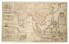
Herman Moll (d. 1732), large hand-coloured map,'A map of East Indies.... to Ye Directors of Ye Hon.ble United East-India Company', 1717, 62cm x 101cm.
£500 - 700
|
|
|
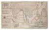
Herman Moll (d. 1732), large hand-coloured map - 'A map of East Indies.... to Ye Directors of Ye Hon.ble United East- India Company', 1717, 62cm x 101cm.
£600 - 800
|
|
|
Herman Moll (d. 1732), large hand-coloured map - 'Asia' presentation to William, Lord Cowper, Lord High Chancellor of Great Britain', printed by Thomas Bowles, Philip Overton and John King, 1717, 58cm x 97cm.
£400 - 600
|
|
|
Herman Moll (d. 1732), hand-coloured map - ' A chart of East-Indies and the Coast of Persia, China, also the Philippina, Moluccan and Sunda Islands & c.' 26cm x 36cm.
£80 - 120
|
|
| |
Herman Moll (d. 1732), six various hand-coloured and uncoloured small maps - including 'The East part of India'; 'The Sunday Islands'.; The Straits of Malacca'; 'Asia'; 'India beyond Ganges'; 'A general and particular history of Asia (title page), all circa 1696-1730 (6).
£150 - 200
|
|
| |
Herman Moll (d. 1732), four various hand-coloured and uncoloured small maps - including 'The Philippine Islands and others of the East Indies' (2); 'The principle Islands of the East Indies explaining what belongs to England, Spain and Holland etc.', 'Philippine Islands agreeable to modern history';all circa 1696-1730 (10).
£100 - 150
|
|
|
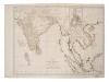
John William Norie (1772-1843), engraved map - 'A new chart of the Straits of Macassar with various additions and improvements', 1831, 93cm x 68cm.
£200 - 300
|
|
|
Jean Baptiste Nolin (1657-1725), hand-coloured map - 'L'Asie', with updates by L. Denis, 1817, 50cm x 67cm.
£100 - 150
|
|
|
John Ogilby (1600-1676), engraved map - 'A new map of Asia', F. lamb sculpt. 1673, 41cm x 52cm.
£150 - 200
|
|
| |
Tomasso Poracchi (1539-1585), hand-coloured map with accompanying Latin text - 'Descrttione Dell'Isole Molucca', 1572, image 11cm x 15cm.
£70 - 100
|
|
| |
Ant. F Prevost (1697-1763), hand-coloured engraving - 'Ile de Baly au Petit Java', 1761, 19cm x 24cm, together with two 19th century maps of East Indian Isles, by Nutall, Fisher & Co., Orr & Smith (3).
£20 - 30
|
|
| |
Joachim Ottens (17th / 18th century), hand-coloured map - 'Le Royaume de Siam Avec Les Royaumes qui Luy sont tributaires', 1740, 36cm x 46cm.
£100 - 150
|
|
|
John Blair (d. 1782), engraved map - 'A Map of the East Indies from the latest Authorities and Observations', 1754, 43cm x 55cm
£100 - 150
|
|
|
Franz Johann Joseph Von Reilly (1766-1820), hand-coloured map - 'Karte von Asien', 51cm x 66cm.
£80 - 120
|
|
|
Nicolas Sanson (1600-1667), hand-coloured map - 'Partie Meridionale de l'Inde', dated 1654, 38cm x 52cm.
£150 - 200
|
|
| |
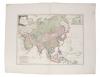
John Senex (d.1740), hand-coloured map - 'A New Map of Asia', 1721, 49cm x 56cm
£100 - 150
|
|
| |
John Russell (18th / 19th century), hand-coloured map - 'Asia from the best authorities', 1810, 19cm x 22cm, together with two late 19th century maps - 'Siam, Burma & Anam' 'Malay Archipelago'. (3)
£100 - 150
|
|
| |
Aime Robiquet (19th century), large chart - 'Mer de Chine et Isles Philippines', dated 1866, image 67 x 100cm.
£50 - 70
|
|
| |
Aime Robiquet (19th century), large chart - 'Carte Generale des Isles de la Sonde' dated 1868,
£50 - 70
|
|
|
Heinrich Scherer (1628-1704), engraved map - 'Insulae Indicae cum Terris Circumvivinis', circa 1700, 23cm x 35cm.
£120 - 160
|
|
| |
Heinrich Scherer (1628-1704), hand-coloured map - 'Insularum Marianarum cum Insulis De Pais Marianis....' circa 1700, 23cm x 35cm.
£40 - 60
|
|
| |
Robert de Vaugondy (1723-1786), hand-coloured map - 'L'Asie' 23cm x 29cm, together with a smaller variant by the same cartographer and small map of Asia by R. Reynolds, 1774 (3).
£60 - 100
|
|
|
Nicholas Sanson (1600-1667), small hand-coloured map - 'Les Isles de la Sonde', 1683, 19 x 25cm
£80 - 120
|
|
| |
Nicholas Sanson (1600-1667), hand coloured map 'Insulae Moluccae', 1720, 19 x 25cm
£40 - 60
|
|
|
Nicholas Sanson (1600-1667), hand coloured map - ' Les Isles Philippines - Islas de Los Ladrones', 19 x 25cm,
£100 - 150
|
|
| |
Isaak Tirion (d.1769), hand-coloured map - 'Nieuwe Kaart van Asia', 28cm x 36cm, 1740
£80 - 120
|
|
| |
Isaak Tirion (d.1769), hand-coloured map - 'Nieuwe Kaart van Asia', 28cm x 36cm, 1740
£60 - 100
|
|
| |
Francois Valentyn (18th century), two uncoloured charts - 'Nieuwe Caart der eylanden van Banda'; 1724, 32cm x 39cm.
£80 - 120
|
|
| |
Francois Valentyn (18th century), uncoloured chart - 'De Landvoogdy van Amboina', 1724, 32cm x 39cm.
£80 - 120
|
|
|
Nicolas Vischer (1618-1679), hand-coloured map - 'Asiae Nova Delineato', 1680, 46cm x 54cm.
£200 - 300
|
|
| |
John Tallis (19th century), group of seven small printed maps - 'Overland route to India' and others, 32cm x 23cm, together with Henry Teasdale, 19th century map - 'Birman Empire...'; Thierry - 'Carte de la Malaisie ou Grande Archipel D' Asia' (9).
£60 - 100
|
|
|
Edward Wells (1667-1727), hand-coloured map - 'Present Asia', 1701, 37cm x 51cm.
£80 - 120
|
|
| |
James Wyld the Elder (1790-1836), hand-coloured map - 'Asia', 1827, 52cm x 64cm.
£30 - 50
|
|
| |
Frederick de Wit (1610-1698), hand-coloured map - 'Tabula Indiae Orientalis', dated 1662, 47cm x 56cm
£150 - 200
|
|
| |
Jan Wolters (17th century), engraved map - 'Indiae Orientalis Insularum Adiacentium', 1697, 22cm x 27cm.
£50 - 70
|
|
|
Antonio Zatta (fl. 1757-1797), hand-coloured map - 'Indie Orientali', published Venice 1784, 33cm x 42cm
£100 - 150
|
|
|
Antonio Zatta (fl. 1757-1797), hand-coloured map - 'Isole Filippine' published Venice 1784, 33cm x 42cm
£100 - 150
|
|
| |
Group of 19th century Far Eastern maps - including two of Burman Empire, by James Wyld; Robert Wilkinson - 'The Islands of the East Indies'; two by Edward Weller (5)
£50 - 70
|
|
| |
Charles Wilson (19th century), large folding chart - The China Sea, dated 1874, 77 x 65cm
£50 - 70
|
|